Blueside
Free EFB for iPad with FAA charts, plates and weather
- In development
- iPad
- iPhone
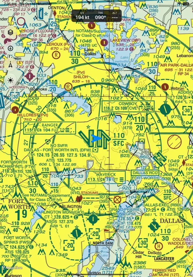
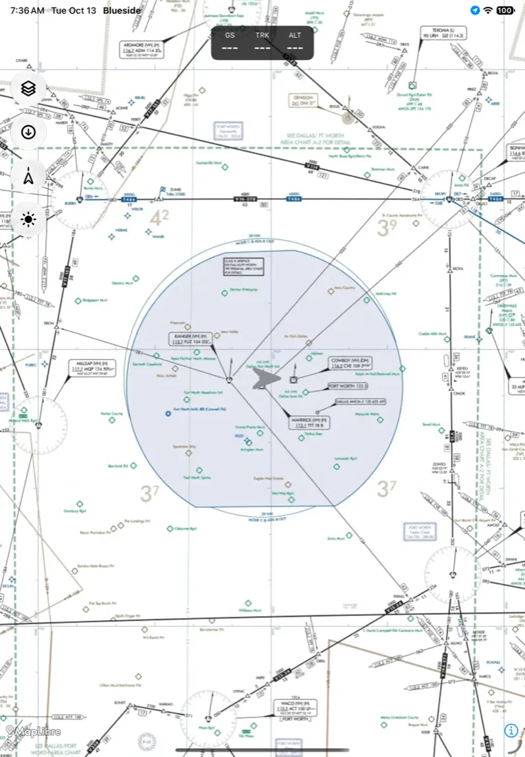
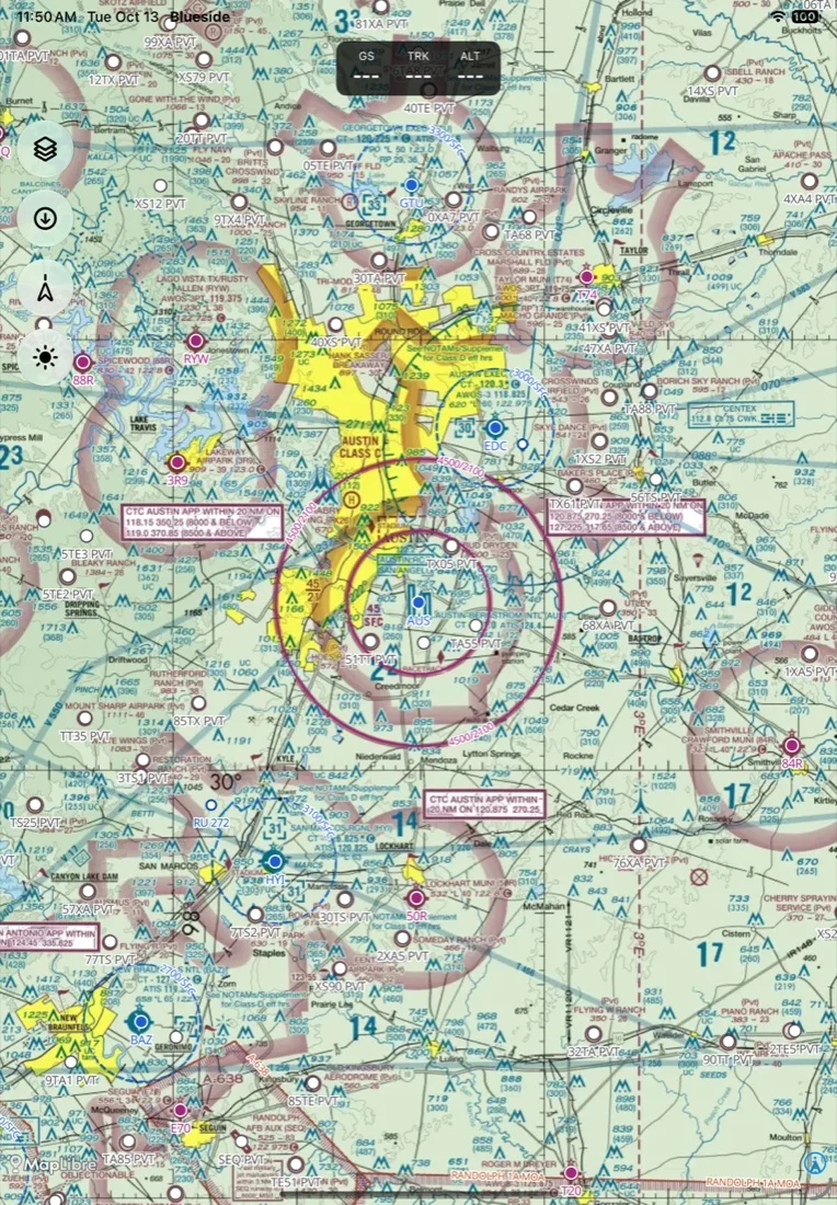
Blueside is a free electronic flight bag (EFB) for pilots in the United States. It has FAA VFR sectional charts, IFR low enroute charts, approach plates and airport diagrams, a moving map, route planning, and aviation weather, and the charts work offline with no cell signal.
I'm a private pilot, and I fly with ForeFlight. Everything underneath it, the charts, the airport data and the weather, is a free download from the FAA and NOAA. Blueside is my attempt to build a modern iPad app on that public data, with the whole pipeline and app in a public repo.
There's no account, no subscription and no tracking. It's in early development, nobody has certified it, and you shouldn't navigate with it yet.
- Price
- Free
- Chart coverage
- 50 states
- Account
- None
- License
- PolyForm NC
Features
VFR sectionals for all 50 states
A server downloads the FAA's sectional sheets every day, trims the borders and joins them into one map. Terminal Area Charts take over as you zoom in.
IFR low enroute charts
The IFR low charts for the lower 48, with the area charts stitched in.
Approach plates and airport diagrams
The FAA's terminal procedures, downloaded per state and opened full screen.
Airports and airspace
Airport search, airport pages, nearest airports, favorites and Direct To from the FAA's 28-day data. Class B, C, D and E airspace and special use airspace are drawn on the map.
Route planning
Type a route like KAUS CWK V565 LFK KLFK and Blueside expands the airway fix by fix, gives each leg a magnetic course and draws the line. Drag the line to bend it.
Aviation weather
Radar, METARs, TAFs, PIREPs, SIGMETs, G-AIRMETs and TFRs as map layers.
Works offline
Download the states you fly in. Charts, plates and airport data stay on the device and draw with no signal. A new chart edition switches over on its effective date.
Moving map
North up or track up, with groundspeed, track and altitude across the top. Touch two fingers to the map for a distance ruler.
Release history
3 milestones since October 2026.
- Milestone
October 2026
Airports, plates, routes and weather on the map
Routes and platesLatest- Airport search, airport pages, nearest airports, favorites and Direct To.
- FAA airport diagrams and approach plates, downloaded per state.
- Routes with labelled waypoints. Drag the line to bend the route, with Undo.
- Radar and weather layers, plus Class E and special use airspace.
IFR charts, nav data, weather and the route engine
Pipeline- IFR low and area charts added to the chart pipeline.
- FAA airport and airspace data built into a database and vector tiles.
- Weather mirror for METAR, TAF, SIGMET, G-AIRMET, PIREP, TFR and radar.
- Route engine with airway expansion and magnetic variation.
First commit
Started- Shared Swift core for chart packs, position and geo math.
- VFR pipeline turning FAA sectional and terminal charts into state packs.
- iOS app showing the map on bundled chart packs.
Roadmap
- Done
Charts, airports, routes and weather
Sectionals, IFR low charts, plates, airport pages, route planning and weather layers.
- Next
Position on approach plates
Show the aircraft on the plates the FAA has georeferenced.
- Later
ADS-B receivers and NOTAMs
Traffic and in-flight weather from portable ADS-B receivers, and NOTAMs.
- Later
Android
The shared Swift core already compiles for Android. The Android app comes after the iPad app.
FAQ
Is Blueside a ForeFlight alternative?
It covers the core of what I use ForeFlight for in a small plane: charts, plates, airports, routes, weather and a moving map. ForeFlight does far more and has years of flying behind it. Blueside isn't affiliated with ForeFlight.
Is Blueside open source?
The full source code is public on GitHub, and you can read it, build it, change it and share it for free. The PolyForm Noncommercial license forbids selling it, so by the Open Source Initiative's definition it's source-available.
Does Blueside cost anything?
No. There's no price, no subscription, no account and no in-app purchase.
Does it work without cell signal?
Yes. Download the states you fly in and the charts, plates and airport data stay on the device. Weather and aerial imagery need a connection.
Can flight schools and instructors use it?
Yes. The license has an extra grant that lets pilots, instructors, flight schools, flying clubs and operators use the app in flight operations and instruction, including flights for hire.
Is there an Android version?
Not yet. It's on the roadmap.
Blueside
Free EFB for iPad with FAA charts, plates and weather